Summer is fast approaching here in Korea, and that means little to no hiking for me because frankly, I enjoy not having heatstroke.
Before it got unbearable, I decided to take a trip to Bukhansan to kick off my attempt at BlackYak’s 명산 100 challenge (spoiler: I didn’t make it to the peak. You’ll find out why soon :’) )
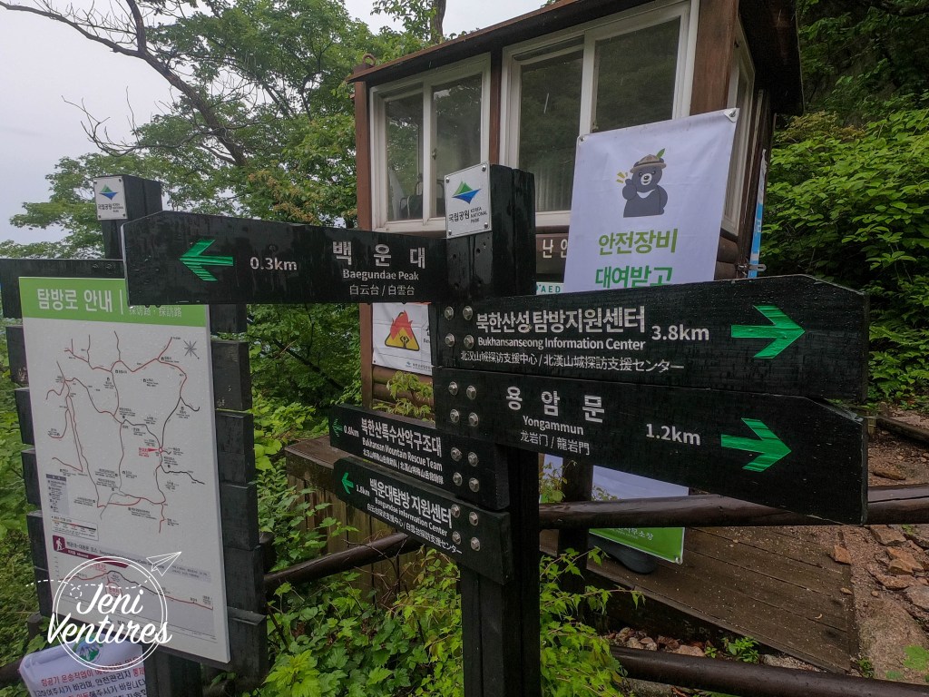
We started off at Gupabal Station (line 3) and headed out of exit 1 towards the bus stops. After taking bus 704, we started walking towards the entrance to the park, and this is where things got interesting.
The whole day was forecast to be overcast, but not rainy – until the moment we got off the bus and it changed its mind. It didn’t just sprinkle. Nay nay. It POURED. Luckily there was a convenience store on the road leading up to the park, so we popped in to grab some rain ponchos to keep our stuff dry.


We checked on the rain and it was only forecast to stay for a little bit, so we just kept on plan. After you enter the park, there’s a little ways to go before you actually start climbing, and the rain kind of let up on the way. This is where we made our next mistake.

So let me start off by saying, we didn’t know what we were getting into with the “difficult” course. We were anxious about it but we were up for challenging ourselves, and we also started pretty late (it was going on 12pm by this point) so we chose to take the shorter route (mistake) not knowing the fire coming drastic weather change coming up (bigger mistake).
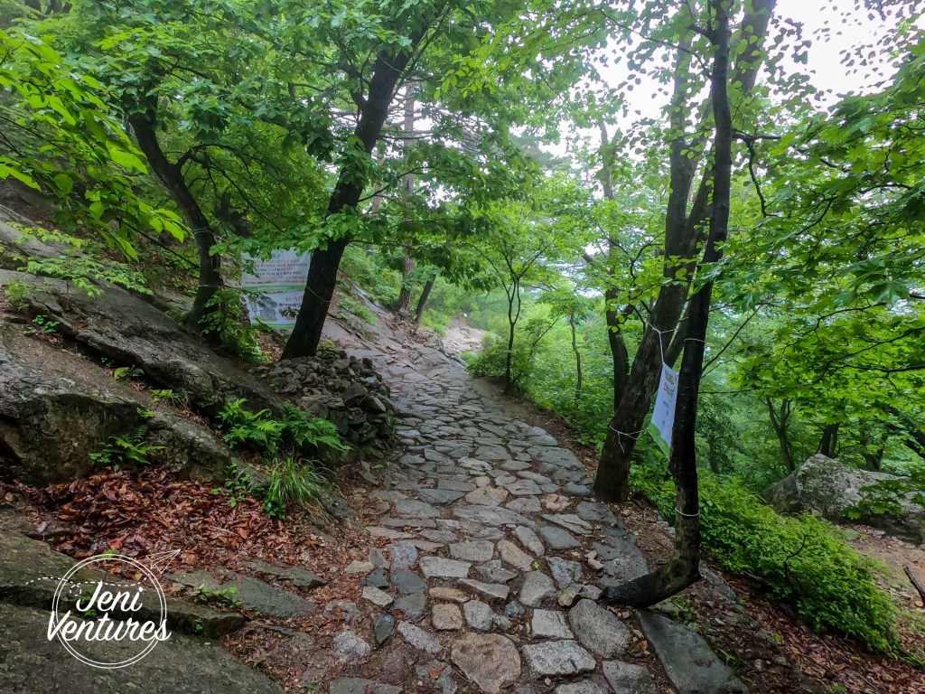
The climb to start off with was not too bad. We had to be a little more vigilant with our footing because of the uneven path, but it wasn’t anything we hadn’t encountered before.


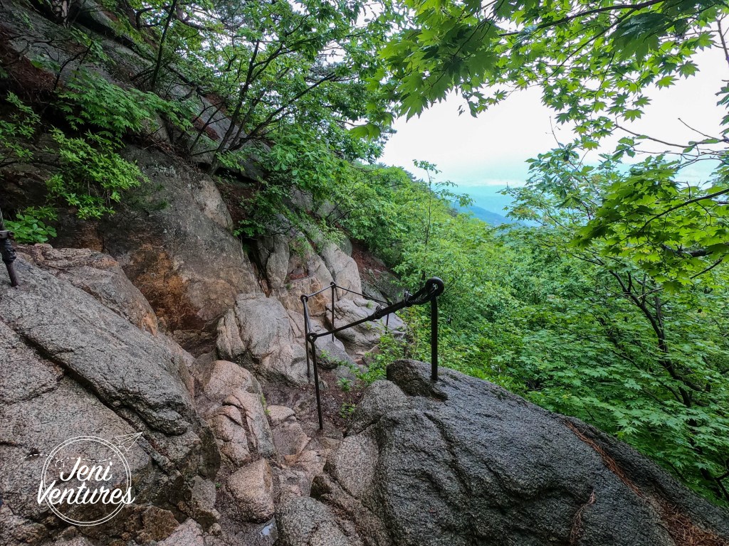
The further we got, the more we realised that maybe we had made a mistake with our choice of route. It may not have been so bad if it had been dry, but as soon as we started on the more tricker parts of the climb, the heavens OPENED.
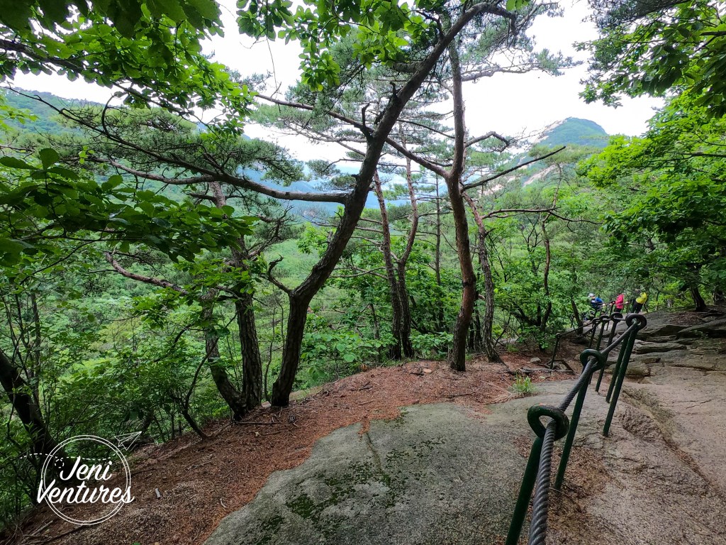
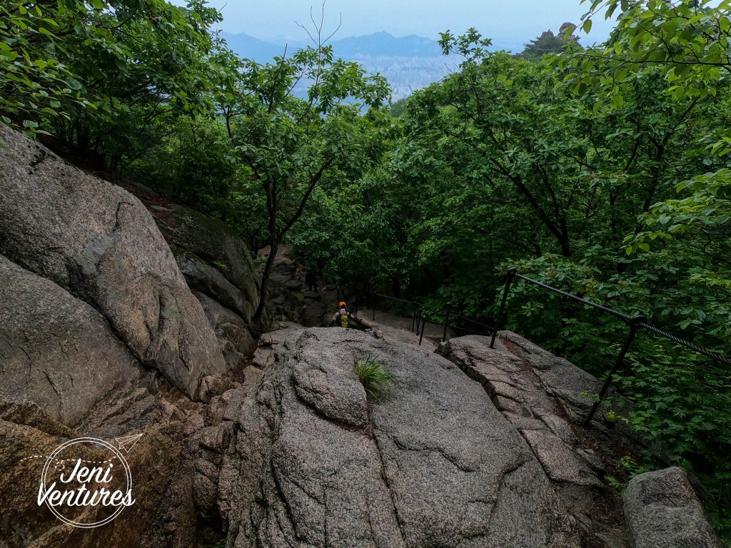
Many of the rocks on this trail are large and unsteady, and the added water and moss made them EXTREMELY slippery. Hikers coming down this trail were slipping all over the place, and after witnessing multiple accidents (plus a person on a stretcher being carried by emergency services. Won’t speculate on their condition out of respect) we decided the best plan was to keep heading upwards and not risk an accident coming down this way. We figured that once we got to the peak, we could head down the ‘easy’ trail that we should have taken earlier. That being said, this trail was absolutely stunning!
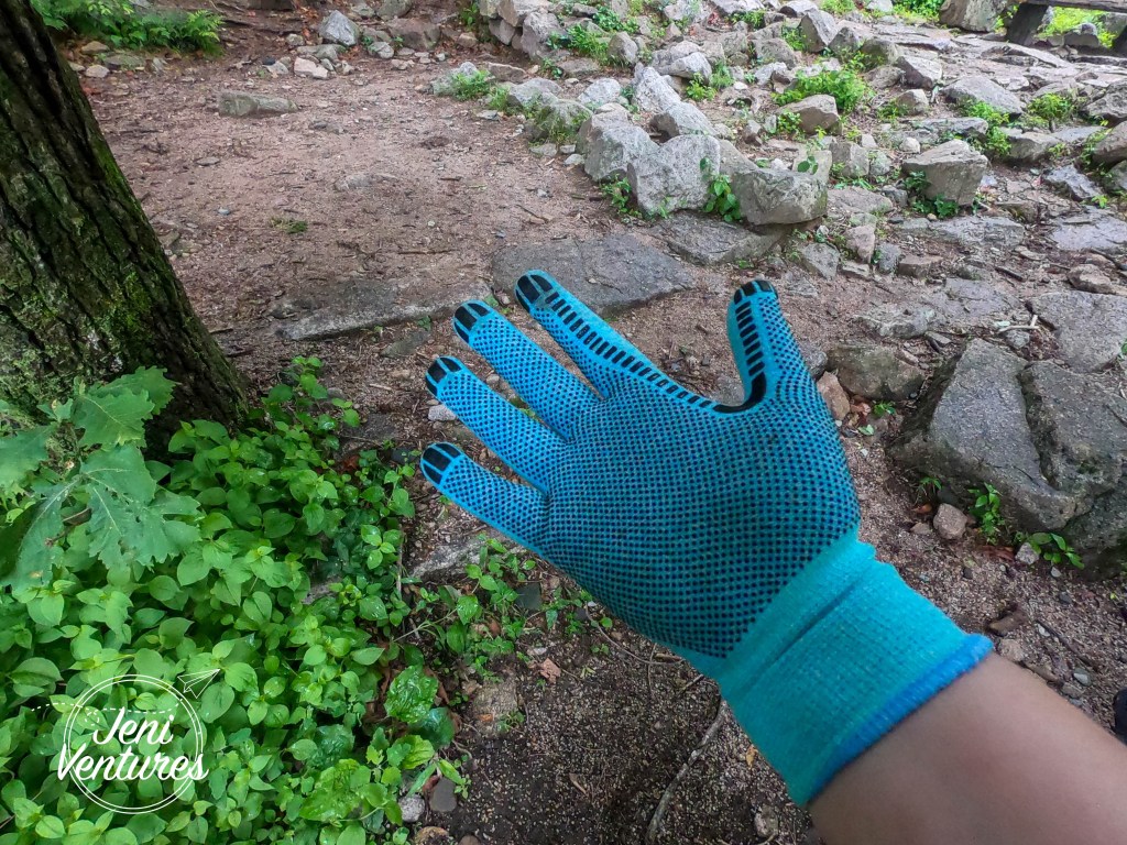
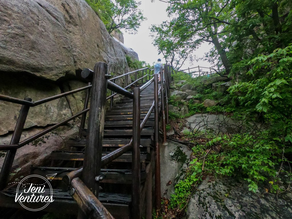
I HIGHLY recommend buying hiking gloves for this mountain. Not only are there steel cables to help you up the rock face, I had to grab sharp rocks to help steady myself and pull myself up onto bigger ones.

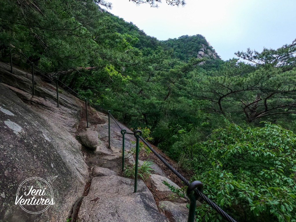

I didn’t manage to take a lot of pictures because I needed both of my hands to climb most of the time, and I couldn’t risk losing my footing or balance trying to take pictures, because as you’ll see by the next picture, one wrong move and I’d be straight off the side of the mountain. oops.

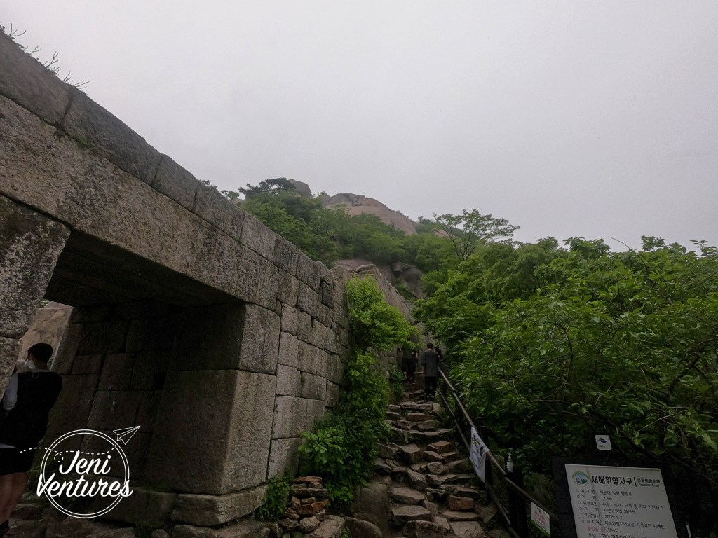
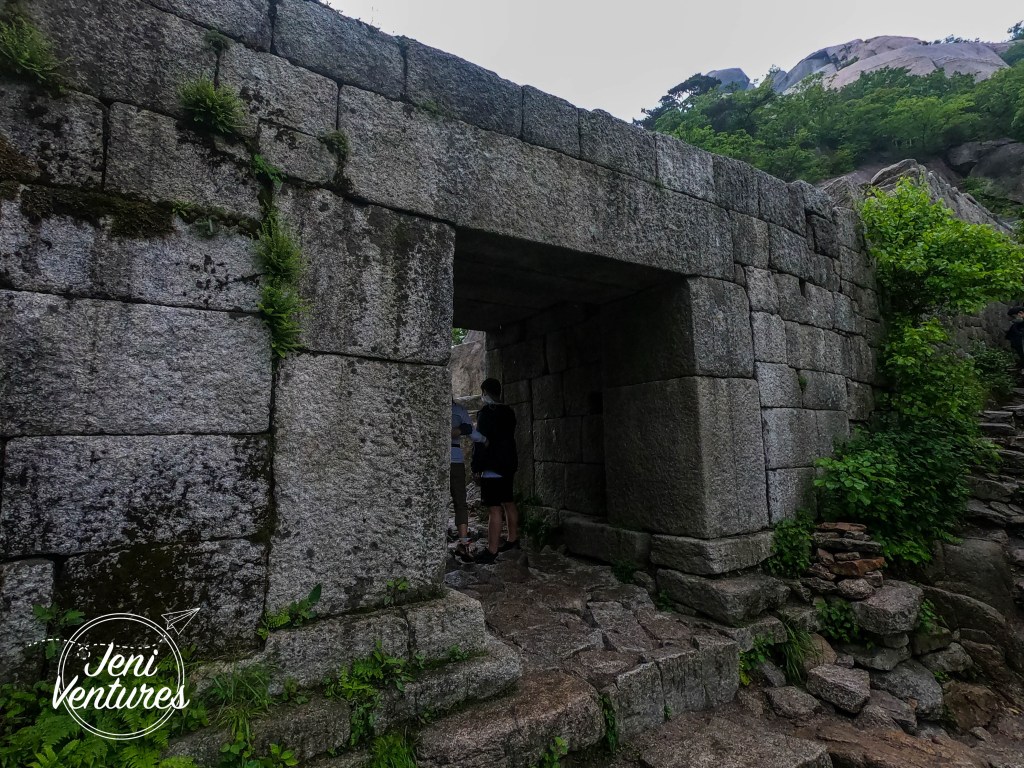
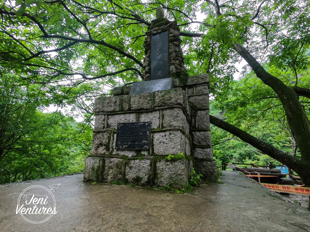
It took us a little while to get to the top, where we were greeted with (very welcome) flat stairs to take us to the gate, where most routes meet before the difficult climb to the peak.
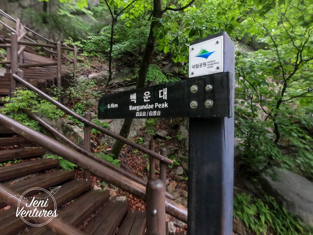

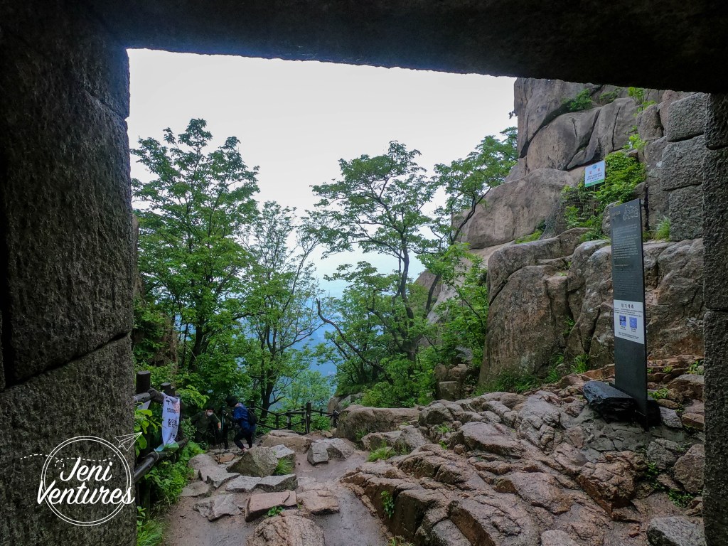
We decided this day not to attempt the peak. Even though it was only 300 metres away, the route up is more flat cliff face and steel cables – which we really didn’t want to risk attempting in the downpour. This also means I couldn’t get my certification for the challenge, so I will have to revisit in the fall when it’s cooler!
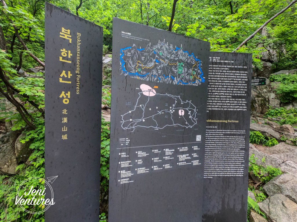
After looking at the map, we decided to take the ‘intermediate’ way down – which although wasn’t fantastic, was much better than the way we came up. There were still cables to deal with, however the incline was MUCH less steep. There were a lot more actual staircases too – of which there were none on the other trail. Just rocks and danger.


This trail brought us down the other side of the mountain, where we had to walk about another 25ish minutes to Bukhansan Ui station (북한산우이) which honestly sounds like a good place to start next time, now that I’m familiar with the route!
Do I advise taking the expert route? Definitely not in the rain. However if you are brave and fit (I am not, for the record.) give it a go – but please be careful!
Want to travel South Korea but don’t know where to start? Visit Korean Travel Hunter to find tours to suit every traveller!
